
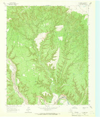
1960 Map of Indian Peak
USGS Topo · Published 1963About this map
The Prairie Dog Town Fork Red River Palo Duro Canyon dominates this landscape where the high plains break into the dramatic erosion of the Texas Panhandle. Ranching and seasonal livestock management are the primary human imprints on the land, evidenced by several remote outposts such as Dinner Creek Camp and Hackberry Camp. The topography is defined by the massive Stinkhole Divide which separates drainage basins above the canyon floor.
Find a feature on this map
44 named features on this map. Tap any name to fly to it.
Don’t see what you’re looking for? This feature index may not catch every label — zoom into the map to look around manually.
Map Details
Editions of this 1960 Indian Peak Map
This is the sole edition of this map. No revisions or reprints were ever made.
Other maps of this area

1954 · Plainview
USGS Topo · 1:250,000

1958 · Plainview
USGS Topo · 1:250,000

1960 · Brice
USGS Topo · 1:62,500

1963 · Paloduro
USGS Topo · 1:24,000

1963 · Tate Arroyo
USGS Topo · 1:24,000
1963 · Gip Creek
USGS Topo · 1:24,000

1963 · Clarendon SW
USGS Topo · 1:24,000

1965 · Ross Canyon
USGS Topo · 1:24,000

1965 · Big Betty Reservoir
USGS Topo · 1:24,000

1965 · Silverton
USGS Topo · 1:24,000