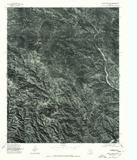
1976 Map of Indian Peak NE
USGS Topo · Published 1978About this map
Battle Creek defines the rugged drainage pattern of this landscape, carving a prominent path through the panhandle terrain of Briscoe. Produced as an orthophotograph from 1976 aerial imagery, this sheet provides a photographic record of the land surface before digital mapping predominated. The winding course of Willow Arroyo joins the primary creek, revealing a network of smaller draws and erosion patterns characteristic of the region's breaks. Unlike traditional line-drawn maps, this visual record shows the actual vegetation and soil exposure of the era, offering a direct view of the Texas landscape's physical state during the mid-1970s. It captures the intersection of natural watercourses in an area defined more by its geological relief than by human infrastructure.
Find a feature on this map
2 named features on this map. Tap any name to fly to it.
Don’t see what you’re looking for? This feature index may not catch every label — zoom into the map to look around manually.
Map Details
Editions of this 1976 Indian Peak NE Map
This is the sole edition of this map. No revisions or reprints were ever made.
Other maps of this area

1954 · Plainview
USGS Topo · 1:250,000

1958 · Plainview
USGS Topo · 1:250,000

1960 · Indian Peak
USGS Topo · 1:62,500

1960 · Brice
USGS Topo · 1:62,500

1963 · Paloduro
USGS Topo · 1:24,000

1963 · Tate Arroyo
USGS Topo · 1:24,000

1963 · Clarendon SW
USGS Topo · 1:24,000
1976 · Indian Peak SW
USGS Topo · 1:24,000

1976 · Brice NW
USGS Topo · 1:24,000
1976 · Indian Peak NW
USGS Topo · 1:24,000