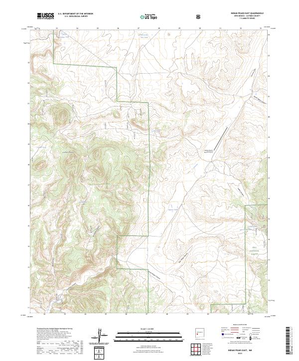
2023 Map of Indian Peaks East
USGS Topo · Published 2023About this map
Gila National Forest encompasses the southern portion of this landscape, where the terrain is defined by a series of steep drainages including Springtime Canyon and Sand Canyon. The topography is centered on the prominent Indian Peaks, with elevations rising and falling across a complex network of canyons and draws. Human activity in this arid New Mexico environment is marked by scattered livestock or wildlife watering points such as Silver Dollar Tank, Elk Tank, and Tub-in-the-Flat Tank. The presence of the Adobe Ranch Private Airport suggests a remote ranching operation that relies on private air access. Historical land divisions are clearly noted through township and range boundaries, while the northern reaches transition into the broad basin of Corduroy Draw. The map documents a landscape where seasonal water flow and ranching infrastructure dictate the local geography.
Find a feature on this map
23 named features on this map. Tap any name to fly to it.
Don’t see what you’re looking for? This feature index may not catch every label — zoom into the map to look around manually.
Map Details
Editions of this 2023 Indian Peaks East Map
This is the sole edition of this map. No revisions or reprints were ever made.
Other maps of this area

1911 · Alum Mountain
USGS Topo · 1:125,000

1913 · Alum Mountain
USGS Topo · 1:125,000

1918 · Pelona
USGS Topo · 1:125,000

1949 · Lookout Mountain
USGS Topo · 1:62,500

1954 · Tularosa
USGS Topo · 1:250,000

1954 · Clifton
USGS Topo · 1:250,000

1957 · Clifton
USGS Topo · 1:250,000

1958 · Clifton
USGS Topo · 1:250,000

1958 · Tularosa
USGS Topo · 1:250,000

1962 · Clifton
USGS Topo · 1:250,000