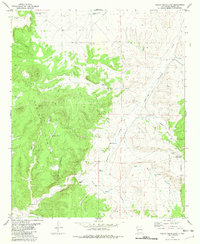
1981 Map of Indian Peaks East
USGS Topo · Published 1981About this map
Gila National Forest dominates this western New Mexico landscape, characterized by the prominent heights of the Indian Peaks. The mapping reveals a land defined by water scarcity and ranching infrastructure, where named catchments like Silver Dollar Tank, Springtime Tank, and Overhill Tank are critical markers for navigation and survival. The presence of Gibson Well and scattered mechanical landmarks like Little Windmill and Sand Windmill highlight the remote pastoral economy of Catron County.
Find a feature on this map
27 named features on this map. Tap any name to fly to it.
Don’t see what you’re looking for? This feature index may not catch every label — zoom into the map to look around manually.
Map Details
Editions of this 1981 Indian Peaks East Map
This is the sole edition of this map. No revisions or reprints were ever made.
Other maps of this area

1911 · Alum Mountain
USGS Topo · 1:125,000

1913 · Alum Mountain
USGS Topo · 1:125,000

1918 · Pelona
USGS Topo · 1:125,000

1949 · Lookout Mountain
USGS Topo · 1:62,500

1954 · Tularosa
USGS Topo · 1:250,000

1954 · Clifton
USGS Topo · 1:250,000

1957 · Clifton
USGS Topo · 1:250,000

1958 · Clifton
USGS Topo · 1:250,000

1958 · Tularosa
USGS Topo · 1:250,000

1962 · Clifton
USGS Topo · 1:250,000