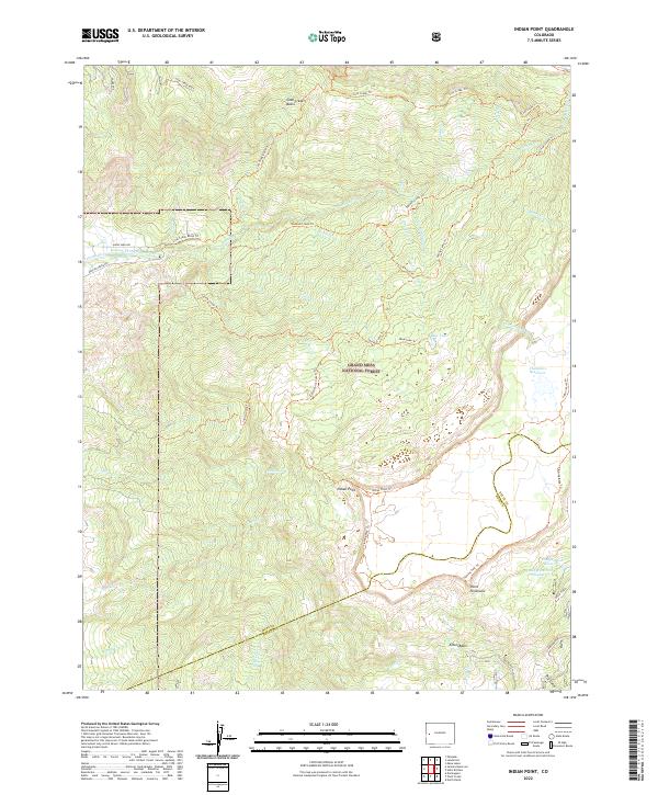
2022 Map of Indian Point
USGS Topo · Published 2022About this map
The high plateau of the Grand Mesa National Forest dominates this topographic study, where the borders of Mesa and Delta counties meet. The landscape is defined by its complex hydrology, featuring an extensive network of irrigation and water management systems such as the Juniata Ditch and the Kannah Cr Highline Ditch. These man-made features contrast with the natural drainage of Kannah Cr and the sheer vertical relief of Indian Point and Point Peninsula. A dense system of historical trails, including the Flowing Park Trl and Spring Camp Trl, crisscrosses the basins and rims, indicating a long-established pattern of high-altitude navigation and resource access. To the southeast, specialized water storage is evident at Doughspoon Reservoir and Delta Reservoir Number 3, supporting the agricultural needs of the lower valleys from this elevated watershed.
Find a feature on this map
44 named features on this map. Tap any name to fly to it.
Don’t see what you’re looking for? This feature index may not catch every label — zoom into the map to look around manually.
Map Details
Editions of this 2022 Indian Point Map
This is the sole edition of this map. No revisions or reprints were ever made.
Other maps of this area

1955 · Skyway
USGS Topo · 1:24,000

1956 · Moab
USGS Topo · 1:250,000

1956 · Grand Junction
USGS Topo · 1:250,000

1959 · Grand Junction
USGS Topo · 1:250,000

1959 · Moab
USGS Topo · 1:250,000

1960 · Moab
USGS Topo · 1:250,000

1960 · Grand Junction
USGS Topo · 1:250,000

1962 · Moab
USGS Topo · 1:250,000

1962 · Grand Junction
USGS Topo · 1:250,000
1962 · Lands End
USGS Topo · 1:24,000