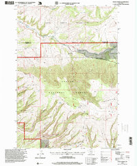
1996 Map of Indian Spring
USGS Topo · Published 1999About this map
Crow Indian Reservation and the Custer National Forest meet at a jurisdictional boundary that defines the northern half of this landscape. The transition from reservation land into the national forest is marked by a dramatic shift in topography as the terrain rises toward Pryor Mountain. Numerous deep drainages, including Timber Canyon, Inferno Canyon, and King Canyon, carve into the limestone uplands, creating a complex network of ridges and seasonal water sources.
Find a feature on this map
26 named features on this map. Tap any name to fly to it.
Don’t see what you’re looking for? This feature index may not catch every label — zoom into the map to look around manually.
Map Details
Editions of this 1996 Indian Spring Map
This is the sole edition of this map. No revisions or reprints were ever made.
Other maps of this area

1954 · Billings
USGS Topo · 1:250,000

1957 · Billings
USGS Topo · 1:250,000

1958 · Billings
USGS Topo · 1:250,000

1964 · Big Ice Cave
USGS Topo · 1:24,000

1964 · Red Pryor Mountain
USGS Topo · 1:24,000

1967 · Castle Rocks
USGS Topo · 1:24,000

1967 · Deep Creek SW
USGS Topo · 1:24,000

1967 · Section House Draw
USGS Topo · 1:24,000

1969 · Warren
USGS Topo · 1:24,000

1969 · Bowler
USGS Topo · 1:24,000