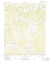
1978 Map of Indian Springs
USGS Topo · Published 1985About this map
The Meramec River winds through the heart of this Crawford County landscape, creating a terrain defined by its water crossings and conservation areas. The river's path is marked by historic river access points such as Scott Ford and Cedar Ford, while the surrounding hills are protected within the Woodson K Woods State Memorial Wildlife Area. Settlement patterns center on the small community of Indian Springs and the southern hamlet of Keysville, which is situated along the tracks of the Burlington Northern railroad near Crooked Creek.
Find a feature on this map
34 named features on this map. Tap any name to fly to it.
Don’t see what you’re looking for? This feature index may not catch every label — zoom into the map to look around manually.
Map Details
Editions of this 1978 Indian Springs Map
3 editions found
Other maps of this area

1903 · Sullivan
USGS Topo · 1:125,000

1928 · Meramec Spring
USGS Topo · 1:62,500

1932 · Steelville
USGS Topo · 1:48,000

1933 · Steelville
USGS Topo · 1:62,500

1934 · Redbird
USGS Topo · 1:62,500

1937 · Steelville
USGS Topo · 1:62,500

1938 · Redbird
USGS Topo · 1:62,500

1948 · Cuba
USGS Topo · 1:24,000

1948 · Leasburg
USGS Topo · 1:24,000

1949 · Saint Louis
USGS Topo · 1:250,000