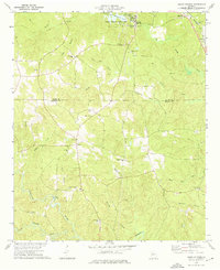
1973 Map of Indian Springs
USGS Topo · Published 1976About this map
Indian Springs State Park dominates the northern landscape of this region on the border of Butts and Monroe counties. Centered around the mineral spring and McIntosh Lake, the area shows a transition from recreational parkland to the small town of Flovilla, which is served by the Southern railroad line. To the south, the terrain becomes a dense network of creek branches and agricultural homesteads, marked by numerous country churches such as St Pauls Ch and Mt Vernon Ch.
Find a feature on this map
48 named features on this map. Tap any name to fly to it.
Don’t see what you’re looking for? This feature index may not catch every label — zoom into the map to look around manually.
Map Details
Editions of this 1973 Indian Springs Map
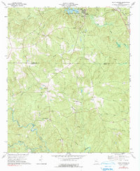
2 editions found
Other maps of this area

1951 · Forsyth
USGS Topo · 1:62,500

1951 · Barnesville
USGS Topo · 1:62,500

1953 · Atlanta
USGS Topo · 1:250,000

1953 · Athens
USGS Topo · 1:250,000

1957 · Atlanta
USGS Topo · 1:250,000

1958 · Athens
USGS Topo · 1:250,000

1958 · Atlanta
USGS Topo · 1:250,000

1959 · Athens
USGS Topo · 1:250,000

1963 · Athens
USGS Topo · 1:250,000

1964 · Lloyd Shoals Dam
USGS Topo · 1:24,000