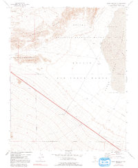
1973 Map of Indian Springs SE
USGS Topo · Published 1991About this map
The Nellis Air Force Range and Desert National Wildlife Range dominate this desert landscape north of Las Vegas, illustrating a region defined by federal oversight and military utility during the 1970s. The terrain is marked by the sharp contrast between the Pintwater Range and low-lying basins like the Desert Depression and Three Lakes Depression. Traces of earlier infrastructure are visible in the form of an Old Railroad Grade cutting diagonally across the restricted zones. Military and industrial activity is evidenced by scattered Bunkers, a Substation, a Tower, and multiple Borrow Pits and Borrow Pits. This survey captures the utilitarian nature of the high desert at a time when the area was strictly partitioned into wildlife refuges and tactical training grounds, as indicated by numerous Restricted areas and a designated Target.
Find a feature on this map
18 named features on this map. Tap any name to fly to it.
Don’t see what you’re looking for? This feature index may not catch every label — zoom into the map to look around manually.
Map Details
Editions of this 1973 Indian Springs SE Map
3 editions found
Other maps of this area

1907 · Las Vegas
USGS Topo · 1:250,000

1908 · Las Vegas
USGS Topo · 1:250,000

1942 · Indian Spring
USGS Topo · 1:125,000

1945 · Sheep Range
USGS Topo · 1:125,000

1952 · Corn Creek Springs
USGS Topo · 1:62,500

1954 · Las Vegas
USGS Topo · 1:250,000

1957 · Las Vegas
USGS Topo · 1:250,000

1957 · Charleston Peak
USGS Topo · 1:62,500

1959 · Las Vegas
USGS Topo · 1:250,000

1962 · Las Vegas
USGS Topo · 1:250,000