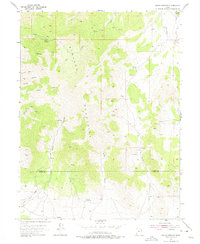
1955 Map of Indian Springs
USGS Topo · Published 1975About this map
The Simpson Mountains dominate this mid-century mid-century topographic survey, revealing a landscape of high-desert peaks and deep canyons along the border of Tooele Co and Juab Co. This era of mapping documents the region's mining and prospecting activity, centered around features like the Bar X Mine and numerous unnamed prospects, tunnels, and a shaft. Water sources were critical to the survival of any operations here, as evidenced by the network of Indian Springs, Antelope Springs, Cherry Springs, and Iron Spring that provided life to an otherwise arid environment.
Find a feature on this map
28 named features on this map. Tap any name to fly to it.
Don’t see what you’re looking for? This feature index may not catch every label — zoom into the map to look around manually.
Map Details
Editions of this 1955 Indian Springs Map
3 editions found
Other maps of this area

1885 · Sevier Desert
USGS Topo · 1:250,000

1885 · Tooele Valley
USGS Topo · 1:250,000

1953 · Tooele
USGS Topo · 1:250,000

1953 · Delta
USGS Topo · 1:250,000

1955 · Simpson Springs
USGS Topo · 1:24,000

1955 · Indian Peaks
USGS Topo · 1:24,000

1955 · Indian Springs
USGS Topo · 1:24,000

1955 · Coyote Springs
USGS Topo · 1:24,000

1955 · Tooele
USGS Topo · 1:250,000

1958 · Delta
USGS Topo · 1:250,000