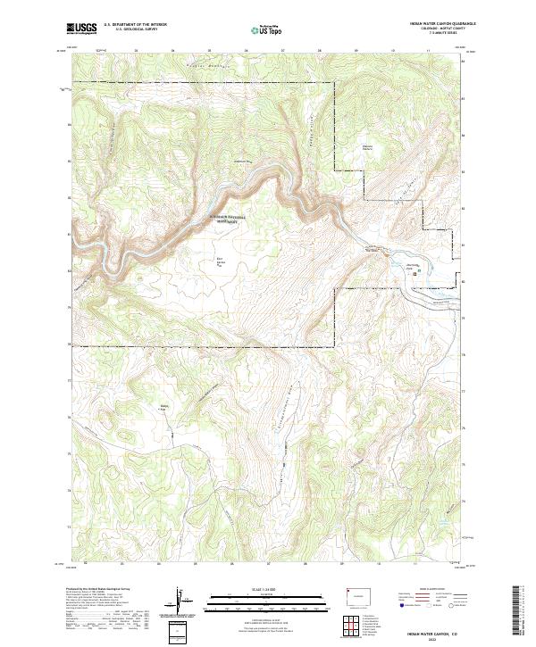
2022 Map of Indian Water Canyon
USGS Topo · Published 2022About this map
Dinosaur National Monument encompasses a significant portion of this high-altitude landscape in Moffat County, where the Yampa River carves through the eastern reaches of the park. The terrain is defined by dramatic elevation changes, from the heights of Douglas Mountain to the depths of Thanksgiving Gorge. The naming conventions found across the sheet reflect a rugged history of land use and navigation, with evocative labels like the Vale of Tears, Disappointment Draw, and The Steps. Small-scale water sources such as Bill White Spring and Dobbins Spring are noted, critical landmarks in a region dominated by sage-covered flats and steep canyons. Remote access is provided by unpaved routes like Deerlodge Road, leading to the river access point at Deerlodge Park, a focal point for those exploring the river corridor.
Find a feature on this map
29 named features on this map. Tap any name to fly to it.
Don’t see what you’re looking for? This feature index may not catch every label — zoom into the map to look around manually.
Map Details
Editions of this 2022 Indian Water Canyon Map
This is the sole edition of this map. No revisions or reprints were ever made.
Other maps of this area

1907 · Rangely
USGS Topo · 1:125,000

1907 · White River
USGS Topo · 1:125,000

1910 · White River
USGS Topo · 1:125,000

1910 · Rangely
USGS Topo · 1:125,000

1954 · Vernal
USGS Topo · 1:250,000

1958 · Vernal
USGS Topo · 1:250,000

1960 · Vernal
USGS Topo · 1:250,000

1960 · Elk Springs
USGS Topo · 1:62,500

1960 · Lone Mountain
USGS Topo · 1:62,500
1962 · M F Mountain
USGS Topo · 1:24,000