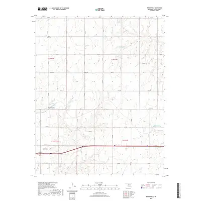
2018 Map of Indianapolis
USGS Topo · Published 2018About this map
The Custer County landscape near Indianapolis and Clinton is defined by an intricate network of reservoirs and creeks that supported the regional agriculture of the late 1960s. Dickey Reservoir, George Cornell Reservoir, and Bozeman and McBride Reservoir serve as prominent water features alongside the flowing waters of Turtle Creek, Bear Creek, and Little Deep Creek. Transportation infrastructure is a central theme of this 1968 map, featuring the iconic Route 66 Highway and the I- 40 Svc Rd, which bisect the rural terrain. Local history researchers can pinpoint several burial sites, including Mount Hope Cemetery, Summit Cemetery, and Newton Cemetery. The gridded network of rural routes like Custer City Road and Arapaho Road illustrates the organized development of this Oklahoma region during the mid-20th century.
Find a feature on this map
37 named features on this map. Tap any name to fly to it.
Don’t see what you’re looking for? This feature index may not catch every label — zoom into the map to look around manually.
Map Details
Editions of this 2018 Indianapolis Map
This is the sole edition of this map. No revisions or reprints were ever made.
Other maps of this area

1955 · Clinton
USGS Topo · 1:250,000

1956 · Cordell
USGS Topo · 1:62,500

1957 · Clinton
USGS Topo · 1:250,000

1957 · Clinton
USGS Topo · 1:62,500

1961 · Eakly
USGS Topo · 1:62,500

1964 · Weatherford
USGS Topo · 1:62,500

1976 · Clinton SE
USGS Topo · 1:24,000

1976 · Clinton SW
USGS Topo · 1:24,000

1976 · Clinton NW
USGS Topo · 1:24,000

1976 · Clinton NE
USGS Topo · 1:24,000