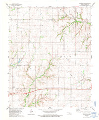
1983 Map of Indianapolis
USGS Topo · Published 1984About this map
The Oklahoma plains of Custer County are defined here by a network of sectional roads and the legacy of early 20th-century agriculture and oil exploration. Centered on Indianapolis, this survey shows a landscape transitioning between the townships of Arapaho, Cedar, and Clinton. The presence of Mt Hope Cem and Summit Cem offers valuable waypoints for genealogists tracing the rural families of this region.
Find a feature on this map
18 named features on this map. Tap any name to fly to it.
Don’t see what you’re looking for? This feature index may not catch every label — zoom into the map to look around manually.
Map Details
Editions of this 1983 Indianapolis Map
This is the sole edition of this map. No revisions or reprints were ever made.
Other maps of this area

1955 · Clinton
USGS Topo · 1:250,000

1956 · Cordell
USGS Topo · 1:62,500

1957 · Clinton
USGS Topo · 1:250,000

1957 · Clinton
USGS Topo · 1:62,500

1961 · Eakly
USGS Topo · 1:62,500

1964 · Weatherford
USGS Topo · 1:62,500

1976 · Clinton SE
USGS Topo · 1:24,000

1976 · Clinton SW
USGS Topo · 1:24,000

1976 · Clinton NW
USGS Topo · 1:24,000

1976 · Clinton NE
USGS Topo · 1:24,000