
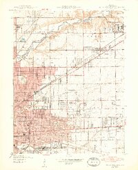
1948 Map of Indianapolis East
USGS Topo · Published 1948About this map
Fort Benjamin Harrison dominates the northeast quadrant of this mid-century landscape, serving as a primary military anchor for the growing Marion County suburbs. The area reflects a transitional post-war economy where aviation and industry are central, evidenced by the Brightwood Airport, Sky Harbor Airport, and the large Naval Ordnance Plant. Traditional residential nodes like Irvington and Millersville are clearly defined alongside a dense network of major transit lines, including the Pennsylvania Railroad and New York Central lines.
Find a feature on this map
58 named features on this map. Tap any name to fly to it.
Don’t see what you’re looking for? This feature index may not catch every label — zoom into the map to look around manually.
Map Details
Editions of this 1948 Indianapolis East Map
2 editions found
Other maps of this area

1948 · Maywood
USGS Topo · 1:24,000

1948 · Beech Grove
USGS Topo · 1:24,000

1948 · Indianapolis West
USGS Topo · 1:24,000

1952 · Cumberland
USGS Topo · 1:24,000

1952 · Fishers
USGS Topo · 1:24,000

1952 · Carmel
USGS Topo · 1:24,000

1952 · Mc Cordsville
USGS Topo · 1:24,000

1953 · Acton
USGS Topo · 1:24,000

1953 · Cincinnati
USGS Topo · 1:250,000

1953 · Indianapolis
USGS Topo · 1:250,000
Featured Places
- Indianapolis, IN
- Lawrence, Indianapolis
- Warren Park, Indianapolis
- Dawnbury, Indianapolis
- Brendonwood, Indianapolis