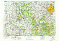
1986 Map of Indianapolis
USGS Topo · Published 1986About this map
Indianapolis serves as the focal point of this 1980s planimetric study, showcasing the dense urban core and its rapidly expanding suburban ring. The map illustrates a mature transportation network dominated by the I-465 beltway, which connects outlying communities like Beech Grove, Speedway, and Lawrence. On the city's northeast side, the Fort Benjamin Harrison Military Reservation stands as a significant federal footprint, while to the west, the Eagle Creek Reservoir and Eagle Creek Park provide a large-scale recreational and water management buffer between the city and Brownsburg.
Find a feature on this map
212 named features on this map. Tap any name to fly to it.
Don’t see what you’re looking for? This feature index may not catch every label — zoom into the map to look around manually.
Map Details
Editions of this 1986 Indianapolis Map
2 editions found
Historical Maps of Indianapolis Through Time
5 maps found