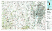
1986 Map of Indianapolis
USGS Topo · Published 1989About this map
The Indianapolis metropolitan region and its surrounding agricultural plains appear here at a peak of late-century suburbanization. The radiating network of interstate highways, including I-465 and I-70, defines the growth of satellite communities like Plainfield, Carmel, and Greenwood. To the northeast, the Fort Benjamin Harrison Military Reservation stands as a significant military enclave before its eventual decommissioning.
Find a feature on this map
150 named features on this map. Tap any name to fly to it.
Don’t see what you’re looking for? This feature index may not catch every label — zoom into the map to look around manually.
Map Details
Editions of this 1986 Indianapolis Map
2 editions found
Other maps of this area

1908 · Clay City
USGS Topo · 1:48,000

1910 · Clay City
USGS Topo · 1:62,500

1942 · Franklin
USGS Topo · 1:125,000

1942 · Columbus
USGS Topo · 1:125,000

1947 · Franklin
USGS Topo · 1:62,500

1948 · Indianapolis East
USGS Topo · 1:24,000

1948 · Franklin
USGS Topo · 1:24,000

1948 · Maywood
USGS Topo · 1:24,000

1948 · Beech Grove
USGS Topo · 1:24,000

1948 · Trafalgar
USGS Topo · 1:24,000