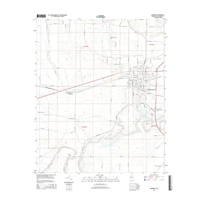
2015 Map of Indianola
USGS Topo · Published 2015About this map
The Big Sunflower River meanders through this landscape, defining the southern and eastern edges of Indianola as it flows past the Riverside Cem. This Mississippi Delta terrain is characterized by an intricate network of waterways including West-Prong Indian Bayou, Beaver Dam Bayou, and Shepherds Bayou, which cut through the agricultural surroundings and the small settlement of Heathman. The map documents the layout of Indianola's street grid, from W Percy St to the newer developments near the Indianola Municipal Airport. Local family and history researchers will find the locations of multiple burial sites, such as Lakewood Cem and Union Grove Cem, as well as the Indianola Memorial Garden, providing a clear record of the community's physical and social footprint.
Find a feature on this map
105 named features on this map. Tap any name to fly to it.
Don’t see what you’re looking for? This feature index may not catch every label — zoom into the map to look around manually.
Map Details
Editions of this 2015 Indianola Map
This is the sole edition of this map. No revisions or reprints were ever made.
Other maps of this area

1934 · Cleveland
USGS Topo · 1:62,500

1939 · Tralake
USGS Topo · 1:62,500

1939 · Choctaw
USGS Topo · 1:62,500

1940 · Baird
USGS Topo · 1:62,500

1940 · Cleveland
USGS Topo · 1:62,500

1953 · Greenwood
USGS Topo · 1:250,000

1956 · Greenwood
USGS Topo · 1:250,000

1965 · Inverness
USGS Topo · 1:24,000

1965 · Indianola
USGS Topo · 1:24,000

1965 · Kinlock
USGS Topo · 1:24,000