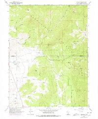
1967 Map of Indianola
USGS Topo · Published 1978About this map
Indianola sits at the junction of mountain canyons and high valley meadows, marking a point of transition between the Utah County and Sanpete County line during the late 1960s. The settlement's history is anchored by the Spencer Cem and the nearby Hilltop marker, while the surrounding landscape is defined by the drainage systems of Thistle Creek and the San Pitch River. Much of the eastern and northern terrain falls within the Manti-La Sal National Forest, where steep ridges like Long Ridge and Beehive Ridge are carved by numerous forks and hollows. Resource extraction and water management are evident through features such as Crotons Mine, the Poulson Well, and a network of pipelines. Remote springs, including Mormon Spring and Quakingasp Spring, suggest the critical importance of water rights in this high-altitude environment.
Find a feature on this map
44 named features on this map. Tap any name to fly to it.
Don’t see what you’re looking for? This feature index may not catch every label — zoom into the map to look around manually.
Map Details
Editions of this 1967 Indianola Map
3 editions found
Other maps of this area

1885 · Manti
USGS Topo · 1:250,000

1895 · Manti
USGS Topo · 1:250,000

1951 · Moroni
USGS Topo · 1:62,500

1952 · Santaquin Peak
USGS Topo · 1:62,500

1956 · Price
USGS Topo · 1:250,000

1960 · Price
USGS Topo · 1:250,000

1962 · Price
USGS Topo · 1:250,000

1965 · Fairview Lakes
USGS Topo · 1:24,000
1967 · Indianola
USGS Topo · 1:24,000
1967 · Mill Fork
USGS Topo · 1:24,000