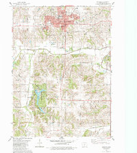
1983 Map of Indianola
USGS Topo · Published 1983About this map
Indianola serves as the focal point of this Warren County study, centered on the historic campus of Simpson College and the surrounding civic core. The map documents the layout of the city in the early 1980s, identifying key public landmarks including the Courthouse, City Hall, and the Post Office. Residential expansion is visible along corridors like Ashland Ave and Chicago Ave, while the eastern outskirts feature the Chicago and North Western rail line and the Pickard Recreation Area.
Find a feature on this map
54 named features on this map. Tap any name to fly to it.
Don’t see what you’re looking for? This feature index may not catch every label — zoom into the map to look around manually.
Map Details
Editions of this 1983 Indianola Map
This is the sole edition of this map. No revisions or reprints were ever made.
Other maps of this area

1910 · Milo
USGS Topo · 1:62,500

1918 · Chariton
USGS Topo · 1:62,500

1931 · Indianola
USGS Topo · 1:62,500

1950 · New Virginia
USGS Topo · 1:62,500

1952 · New Virginia
USGS Topo · 1:62,500

1954 · Des Moines
USGS Topo · 1:250,000

1956 · Des Moines
USGS Topo · 1:250,000

1957 · Des Moines
USGS Topo · 1:250,000

1965 · Milo
USGS Topo · 1:24,000
1965 · Hartford
USGS Topo · 1:24,000