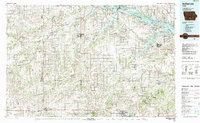
1984 Map of Indianola
USGS Topo · Published 1984About this map
Indianola serves as a central hub for Warren County in this mid-1980s landscape, where the confluence of the North River and Middle River defines the local drainage. The map reveals a transition in land use, showing the heavy engineering of Red Rock Lake and the Red Rock State Wildlife Management Area to the northeast. To the south, Chariton and Osceola anchor the lower section of the map, connected by the Burlington Northern railroad corridors.
Find a feature on this map
111 named features on this map. Tap any name to fly to it.
Don’t see what you’re looking for? This feature index may not catch every label — zoom into the map to look around manually.
Map Details
Editions of this 1984 Indianola Map
This is the sole edition of this map. No revisions or reprints were ever made.
Other maps of this area

1905 · Des Moines
USGS Topo · 1:62,500

1907 · Des Moines
USGS Topo · 1:62,500

1908 · Waukee
USGS Topo · 1:62,500

1909 · Knoxville
USGS Topo · 1:62,500

1910 · Milo
USGS Topo · 1:62,500

1910 · Pella
USGS Topo · 1:62,500

1912 · Knoxville
USGS Topo · 1:62,500

1912 · Pella
USGS Topo · 1:62,500

1918 · Chariton
USGS Topo · 1:62,500

1924 · Melcher
USGS Topo · 1:62,500