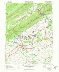
1969 Map of Indiantown Gap
USGS Topo · Published 1972About this map
Indiantown Gap Military Reservation dominates the central landscape, showing the military infrastructure of the late 1960s with its airfields, ranges, and reservoirs like Marquette Lake and State Memorial Lake. The northern portion of the map is defined by the steep ridges of Blue Mountain, Second Mountain, and Sharp Mountain, where the Appalachian Trail follows the high ground. To the south, the terrain transitions into the agricultural valleys of East Hanover and North Annville. This map illustrates the remnants of 19th-century transport alongside modern interstate development, with the historic Union Canal and the Reading railroad corridor following the curves of Swatara Creek through Swatara Gap. Settlements such as Lickdale, Bordnersville, and Harper Tavern are visible, alongside local landmarks like Moonshine Ch and the Bashore Boy Scout Camp.
Find a feature on this map
68 named features on this map. Tap any name to fly to it.
Don’t see what you’re looking for? This feature index may not catch every label — zoom into the map to look around manually.
Map Details
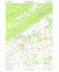
Editions of this 1969 Indiantown Gap Map
2 editions found
Other maps of this area

1891 · Lebanon
USGS Topo · 1:62,500

1892 · Lykens
USGS Topo · 1:62,500

1892 · Hummelstown
USGS Topo · 1:62,500

1892 · Pine Grove
USGS Topo · 1:62,500

1893 · Lykens
USGS Topo · 1:62,500

1893 · Lebanon
USGS Topo · 1:62,500

1899 · Lebanon
USGS Topo · 1:62,500

1924 · Hummelstown
USGS Topo · 1:62,500

1943 · Lebanon
USGS Topo · 1:62,500

1943 · Lykens
USGS Topo · 1:62,500
Featured Places
- East Hanover Township, PA
- Union Township, PA
- Swatara Township, PA
- McGillstown, East Hanover Township
- Indiantown, East Hanover Township