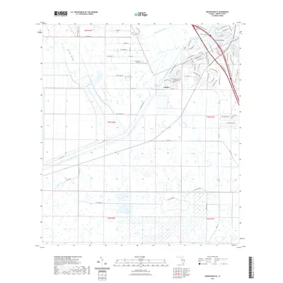
2021 Map of Indiantown SE
USGS Topo · Published 2021About this map
The Saint Lucie Canal and Okeechobee Waterway dominate this Martin County landscape, serving as critical conduits for water management and navigation in South Florida. Near the settlement of Arundel, the infrastructure of the canal system is clearly defined, showing the engineered intersections with natural drainage features like Roebuck Cr and Hog Cr. The map illustrates a transitional landscape where large-scale water control projects meet expanding residential developments, such as the network of roads including SW Old Kansas Ave and SW Ranch Trl near Halpatiokee Regional Park. The presence of the Thomas Mauvel Bridge highlights the necessity of crossing these significant man-made waterways. To the west, the terrain shifts towards more open land and natural features like Green Ridge, providing a contrast to the dense canal-side infrastructure and newer subdivisions.
Find a feature on this map
74 named features on this map. Tap any name to fly to it.
Don’t see what you’re looking for? This feature index may not catch every label — zoom into the map to look around manually.
Map Details
Editions of this 2021 Indiantown SE Map
This is the sole edition of this map. No revisions or reprints were ever made.
Other maps of this area

1948 · Palm City
USGS Topo · 1:24,000

1948 · Rood
USGS Topo · 1:24,000

1948 · St. Lucie Inlet
USGS Topo · 1:24,000

1948 · Gomez
USGS Topo · 1:24,000

1949 · Rood
USGS Topo · 1:24,000

1949 · Gomez
USGS Topo · 1:24,000

1950 · St. Lucie Inlet
USGS Topo · 1:24,000

1950 · Palm City
USGS Topo · 1:24,000

1953 · Indian Town SE
USGS Topo · 1:24,000

1953 · Indian Town NW
USGS Topo · 1:24,000