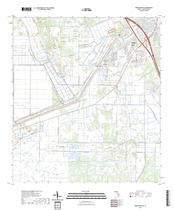
2024 Map of Indiantown SE
USGS Topo · Published 2024About this map
Palm City serves as the primary residential hub on this 2024 landscape, defined by its intricate network of suburban roads such as SW Porpoise Cir and SW Versailles Ter. This developed pocket contrasts sharply with the expansive agricultural and hydrologic management systems to the south and west. The Saint Lucie Canal, which also functions as the Okeechobee Waterway, cuts a prominent diagonal across the terrain, illustrating the critical role of water engineering in Martin County. Further inland, the settlement of Arundel and the operations at Thomas Produce highlight the area's ongoing agricultural heritage. Natural drainage features like Hog Creek and Roebuck Creek weave through the flatter plains, while Green Ridge provides a subtle change in elevation amidst the grid of rural roads and drainage canals.
Find a feature on this map
81 named features on this map. Tap any name to fly to it.
Don’t see what you’re looking for? This feature index may not catch every label — zoom into the map to look around manually.
Map Details
Editions of this 2024 Indiantown SE Map
This is the sole edition of this map. No revisions or reprints were ever made.
Other maps of this area

1948 · Palm City
USGS Topo · 1:24,000

1948 · Rood
USGS Topo · 1:24,000

1948 · St. Lucie Inlet
USGS Topo · 1:24,000

1948 · Gomez
USGS Topo · 1:24,000

1949 · Rood
USGS Topo · 1:24,000

1949 · Gomez
USGS Topo · 1:24,000

1950 · St. Lucie Inlet
USGS Topo · 1:24,000

1950 · Palm City
USGS Topo · 1:24,000

1953 · Indian Town SE
USGS Topo · 1:24,000

1953 · Indian Town NW
USGS Topo · 1:24,000