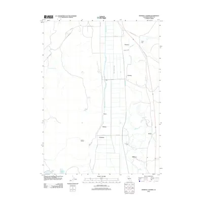
2012 Map of Infernal Caverns
USGS Topo · Published 2012About this map
Agricultural water management and family ranching dominate this corner of Modoc County. The South Fork Pit River serves as the central artery for a complex irrigation network, flanked by the Westside Canal and Eastside Canal. This system sustains a series of named ranching outposts and small settlements, including Fitzhugh Creek Ranch, Corporation Ranch, and Beet Camp. The layout of the land reflects a strictly organized grid of county roads and property boundaries, contrasting with the natural drainage of Crooks Canyon and the marshy basins of Delta Lake and Alkali Lake to the south. Several family names are preserved on the landscape through features like McGarva Reservoir, Wade Williams Spring, and the small community of Christensen.
Find a feature on this map
38 named features on this map. Tap any name to fly to it.
Don’t see what you’re looking for? This feature index may not catch every label — zoom into the map to look around manually.
Map Details
Editions of this 2012 Infernal Caverns Map
This is the sole edition of this map. No revisions or reprints were ever made.
Other maps of this area

1886 · Alturas
USGS Topo · 1:250,000

1892 · Alturas
USGS Topo · 1:250,000

1954 · Alturas
USGS Topo · 1:250,000

1958 · Alturas
USGS Topo · 1:250,000

1961 · Alturas
USGS Topo · 1:62,500

1962 · Alturas
USGS Topo · 1:250,000

1962 · Tule Mountain
USGS Topo · 1:24,000

1962 · Likely
USGS Topo · 1:62,500

1963 · Little Juniper Reservoir
USGS Topo · 1:24,000

1963 · Dorris Reservoir
USGS Topo · 1:24,000