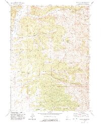
1991 Map of Ingham Canyon
USGS Topo · Published 1991About this map
Ingham Peak anchors this high-elevation landscape within the Grouse Creek Mountains of northwestern Utah, where a network of seasonal drainages and springs defines the remote terrain. The eastern slopes are carved by Ingham Canyon and its namesake Ingham Creek, while the western side features deep incisions like Bill Shaw Canyon and Cook Canyon. This 1991 revision provides a detailed look at the infrastructure of the high desert, including an Aqueduct and several Mines located near the headwaters of the canyons. The presence of numerous named water sources, such as Paskett Spring, Red Knolls Spring, and the North Bedke Springs, underscores the vital importance of water rights in this arid ranching and mining country during the late 20th century.
Find a feature on this map
37 named features on this map. Tap any name to fly to it.
Don’t see what you’re looking for? This feature index may not catch every label — zoom into the map to look around manually.
Map Details
Editions of this 1991 Ingham Canyon Map
This is the sole edition of this map. No revisions or reprints were ever made.
Other maps of this area

1954 · Brigham City
USGS Topo · 1:250,000

1958 · Brigham City
USGS Topo · 1:250,000

1959 · Cotton Thomas Basin
USGS Topo · 1:62,500

1959 · Yost
USGS Topo · 1:62,500

1962 · Brigham City
USGS Topo · 1:250,000

1971 · Emigrant Pass
USGS Topo · 1:24,000
1971 · Toms Cabin Spring
USGS Topo · 1:24,000

1971 · Potters Creek
USGS Topo · 1:24,000
1971 · Grouse Creek
USGS Topo · 1:24,000
1971 · Rocky Pass Peak
USGS Topo · 1:24,000