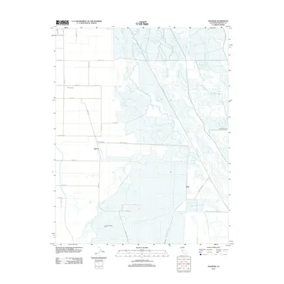
2012 Map of Ingomar
USGS Topo · Published 2012About this map
Agricultural and water management infrastructure dominates this Central Valley landscape near Ingomar. The settlement pattern is defined by large-scale ranching and dairy operations, including Ingomar Ranch, M and C Dairy, and D and D Holsteins Dairy. A complex network of irrigation and drainage channels, such as the Santa Fe Canal, Rubino Ditch, and Kesterson Ditch, crisscrosses the low-lying terrain, highlighting the engineered nature of the region's hydrology. Natural and man-made water features converge here, with Mud Slough and San Luis Creek flowing toward the San Luis Holding Reservoir. The grid of rural roads, including Ingomar Road and Pfizer Road, provides access to these isolated agricultural sites, while the San Luis Wasteway and San Luis Spillway Ditch manage the essential flow of water through the Merced County plains.
Find a feature on this map
35 named features on this map. Tap any name to fly to it.
Don’t see what you’re looking for? This feature index may not catch every label — zoom into the map to look around manually.
Map Details
Editions of this 2012 Ingomar Map
This is the sole edition of this map. No revisions or reprints were ever made.
Other maps of this area

1917 · Newman
USGS Topo · 1:31,680

1918 · Stevinson
USGS Topo · 1:31,680

1918 · Gustine
USGS Topo · 1:31,680

1919 · Orestimba
USGS Topo · 1:62,500

1919 · San Luis Ranch
USGS Topo · 1:31,680

1919 · Ingomar
USGS Topo · 1:31,680

1920 · Pacheco Pass
USGS Topo · 1:62,500

1921 · Volta
USGS Topo · 1:31,680

1921 · Los Banos
USGS Topo · 1:31,680

1922 · San Luis Creek
USGS Topo · 1:31,680