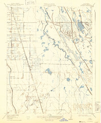
1919 Map of Ingomar
USGS Topo · Published 1943About this map
Southern Pacific railroad tracks dominate the western landscape of this Merced County survey, serving as the industrial backbone for early 20th-century settlements like Ingomar and Linora. The region is defined by a complex drainage system where Garzas Creek and Mud Slough intersect with a grid of irrigation canals and early ranching tracts, such as Eagle Ranch. This network of water management reflects the intensive agricultural development of the San Joaquin Valley following the arrival of reliable rail transport. Near the southern edge, San Luis Creek and Los Banos Creek meander across the plains, while the Old Santa Fe Grade provides a glimpse into the region's earlier transportation history. The map captures a moment when traditional ranching was transitioning into a more structured agricultural economy dependent on both water engineering and the locomotive.
Find a feature on this map
9 named features on this map. Tap any name to fly to it.
Don’t see what you’re looking for? This feature index may not catch every label — zoom into the map to look around manually.
Map Details
Editions of this 1919 Ingomar Map
2 editions found
Other maps of this area

1917 · Newman
USGS Topo · 1:31,680

1918 · Stevinson
USGS Topo · 1:31,680

1918 · Gustine
USGS Topo · 1:31,680

1919 · Orestimba
USGS Topo · 1:62,500

1919 · San Luis Ranch
USGS Topo · 1:31,680

1919 · Ingomar
USGS Topo · 1:31,680

1920 · Pacheco Pass
USGS Topo · 1:62,500

1921 · Volta
USGS Topo · 1:31,680

1921 · Los Banos
USGS Topo · 1:31,680

1922 · San Luis Creek
USGS Topo · 1:31,680