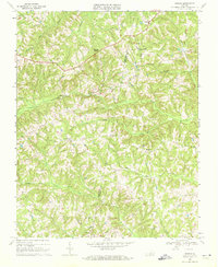
1968 Map of Ingram
USGS Topo · Published 1972About this map
The Pittsylvania Co and Halifax Co border runs through this detailed 1968 study, a landscape of winding creek valleys and dispersed rural settlements. Ingram and Sutherlin serve as primary anchors in an area defined by small country congregations and family farms. The map reveals a dense network of local churches including The Mt Ch, Mt Zion Ch, and Arbor Ch, many with associated burial grounds labeled throughout the terrain. Significant water systems like Birch Creek and Germy Creek dictate the topography, reflecting a traditional Southside Virginia agricultural character. From the small hamlet of Brooklyn to the community at Laurel Grove, the map documents a transition period before modern development, preserving the locations of old schools and home sites that define the region's mid-century social fabric.
Find a feature on this map
27 named features on this map. Tap any name to fly to it.
Don’t see what you’re looking for? This feature index may not catch every label — zoom into the map to look around manually.
Map Details
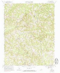
Editions of this 1968 Ingram Map
2 editions found
Other maps of this area

1921 · Chatham
USGS Topo · 1:48,000

1923 · Danville
USGS Topo · 1:48,000

1923 · Chatham
USGS Topo · 1:62,500

1925 · Danville
USGS Topo · 1:62,500

1952 · Milton
USGS Topo · 1:62,500

1953 · Greensboro
USGS Topo · 1:250,000

1954 · Greensboro
USGS Topo · 1:250,000

1954 · Riceville
USGS Topo · 1:62,500

1956 · Milton
USGS Topo · 1:62,500

1962 · Greensboro
USGS Topo · 1:250,000