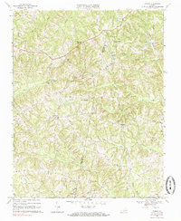
1968 Map of Ingram
USGS Topo · Published 1985About this map
The rural borderland between Pittsylvania County and Halifax County is defined by a dense network of winding creeks and small crossroads settlements. Surveyed in the late 1960s, this area centers on Birch Creek and its many tributaries, including Germy Creek and Double Creek. The landscape is dotted with numerous small family or community cemeteries and landmark houses of worship, such as Mt Zion Ch near Birchland Park and Arbor Ch in the eastern reaches.
Find a feature on this map
26 named features on this map. Tap any name to fly to it.
Don’t see what you’re looking for? This feature index may not catch every label — zoom into the map to look around manually.
Map Details
Editions of this 1968 Ingram Map
2 editions found
Other maps of this area

1921 · Chatham
USGS Topo · 1:48,000

1923 · Danville
USGS Topo · 1:48,000

1923 · Chatham
USGS Topo · 1:62,500

1925 · Danville
USGS Topo · 1:62,500

1952 · Milton
USGS Topo · 1:62,500

1953 · Greensboro
USGS Topo · 1:250,000

1954 · Greensboro
USGS Topo · 1:250,000

1954 · Riceville
USGS Topo · 1:62,500

1956 · Milton
USGS Topo · 1:62,500

1962 · Greensboro
USGS Topo · 1:250,000