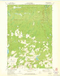
1971 Map of Ingram
USGS Topo · Published 1973About this map
The village of Ingram serves as the primary hub of this 1971 study, situated along the Soo Line railroad near the southern edge of the Flambeau River State Forest. The landscape is defined by the complex drainage of the South Fork Flambeau River, George Ladd Creek, and Skinner Creek, reflecting the glacial history of northern Wisconsin. Genealogy researchers will find the Ingram Cem and several family-named landmarks like McGee Lake clearly delineated. Human activity and industry are evidenced by numerous Gravel Pits, the Ladd Creek Lookout Tower, and the lingering Old Railroad Grade. To the south, the terrain transitions into the townships of True and Richland, where Main Creek and its various forks converge near Lake La Verne.
Find a feature on this map
27 named features on this map. Tap any name to fly to it.
Don’t see what you’re looking for? This feature index may not catch every label — zoom into the map to look around manually.
Map Details
Editions of this 1971 Ingram Map
This is the sole edition of this map. No revisions or reprints were ever made.
Other maps of this area

1941 · Kennan
USGS Topo · 1:48,000

1945 · Kennan
USGS Topo · 1:48,000

1945 · Black River
USGS Topo · 1:48,000

1945 · Ingram
USGS Topo · 1:48,000

1947 · Ingram
USGS Topo · 1:48,000

1947 · Sheldon
USGS Topo · 1:48,000

1949 · Sheldon
USGS Topo · 1:48,000

1949 · Jump River Fire Tower
USGS Topo · 1:48,000

1953 · Rice Lake
USGS Topo · 1:250,000

1959 · Rice Lake
USGS Topo · 1:250,000