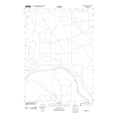
2010 Map of Initial Point
USGS Topo · Published 2010About this map
Initial Point serves as the prominent geographic anchor of this landscape, marking the fundamental survey origin for the state of Idaho. To the south, the Snake River carves a deep arc across the terrain, accompanied by Halverson Lake and the managed water of the Waldvogel Canal. This 2010 survey illustrates a region where high-desert survey lines meet intensive agricultural engineering. The landscape is defined by its rectilinear road network, including Black Cat Rd and Swan Falls Rd, which contrast with the natural meanders of the river. Evidence of local land use and long-standing holdings appears at Priest Ranch, situated along the riverbanks. The map captures the intersection of early pioneer surveying history with modern rural infrastructure, showing how the original baseline at the point influenced the grid-based development of roads like W Initial Point Rd and Warren Spur Rd.
Find a feature on this map
18 named features on this map. Tap any name to fly to it.
Don’t see what you’re looking for? This feature index may not catch every label — zoom into the map to look around manually.
Map Details
Editions of this 2010 Initial Point Map
This is the sole edition of this map. No revisions or reprints were ever made.
Other maps of this area

1892 · Bisuka
USGS Topo · 1:125,000

1892 · Silver City
USGS Topo · 1:125,000

1894 · Bisuka
USGS Topo · 1:125,000

1894 · Silver City
USGS Topo · 1:125,000

1898 · Silver City
USGS Topo · 1:125,000

1947 · Wild Horse Butte
USGS Topo · 1:24,000

1948 · Wild Horse Butte
USGS Topo · 1:24,000

1948 · Sinker Butte
USGS Topo · 1:24,000

1949 · Sinker Butte
USGS Topo · 1:24,000

1949 · Oreana
USGS Topo · 1:62,500