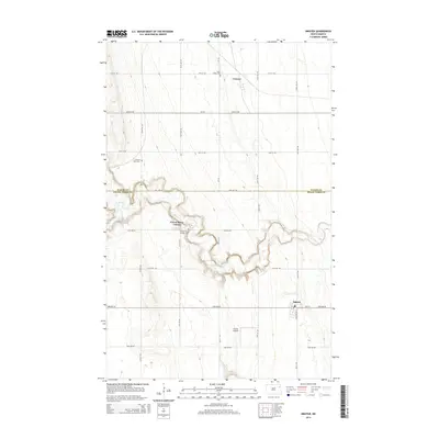
2014 Map of Inkster
USGS Topo · Published 2014About this map
Inkster sits at the southern edge of this Walsh and Grand Forks County borderland, where the prairie grid is interrupted by the deeply etched meanders of the Forest River. This 2014 survey documents the landscape of the Red River Valley’s western edge, characterized by intentional communal settlements like the Forest River Colony and its associated Forest River Colony Cemetery. The river's winding path creates a stark topographical contrast against the surrounding agricultural flats, sheltering small sites like the E Forest River Cemetery. To the north, the small settlement of Conway and the Saint Marks Cemetery mark the transition toward the northern Walsh County plains. The presence of the Inkster Airport south of town indicates the ongoing importance of local aviation in managing these expansive northern North Dakota farmstead reaches.
Find a feature on this map
31 named features on this map. Tap any name to fly to it.
Don’t see what you’re looking for? This feature index may not catch every label — zoom into the map to look around manually.
Map Details
Editions of this 2014 Inkster Map
This is the sole edition of this map. No revisions or reprints were ever made.
Other maps of this area

1952 · Thief River Falls
USGS Topo · 1:250,000

1956 · Thief River Falls
USGS Topo · 1:250,000

1957 · Thief River Falls
USGS Topo · 1:250,000

1963 · Orr
USGS Topo · 1:24,000

1963 · Inkster NE
USGS Topo · 1:24,000

1963 · Pleasant Valley
USGS Topo · 1:24,000

1963 · Fordville SE
USGS Topo · 1:24,000

1963 · Pisek
USGS Topo · 1:24,000

1963 · Veseleyville
USGS Topo · 1:24,000

1963 · Fordville
USGS Topo · 1:24,000