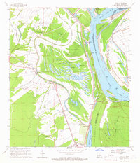
1965 Map of Innis
USGS Topo · Published 1966About this map
The Mississippi River and its intricate network of chutes, bars, and cutoffs dominate this 1965 topographical record of the Louisiana-Mississippi borderlands. The landscape is defined by the massive oxbows of the river, including the Shreves Cutoff and the Raccourci Island area, where abandoned river channels have transformed into a dense cluster of lakes like Big Lake Moreau and Little Lake Moreau. These water bodies are hemmed in by the Texas and Pacific Railroad and the Louisiana and Arkansas Pacific Railroad, illustrating the vital intersection of river and rail transport in the mid-20th century.
Find a feature on this map
78 named features on this map. Tap any name to fly to it.
Don’t see what you’re looking for? This feature index may not catch every label — zoom into the map to look around manually.
Map Details
Editions of this 1965 Innis Map
2 editions found
Other maps of this area

1939 · Artonish
USGS Topo · 1:62,500

1941 · Voorhies
USGS Topo · 1:62,500

1941 · Batchelor
USGS Topo · 1:62,500

1953 · Natchez
USGS Topo · 1:250,000

1954 · Artonish
USGS Topo · 1:62,500

1954 · Baton Rouge
USGS Topo · 1:250,000

1955 · Artonish
USGS Topo · 1:62,500

1955 · Batchelor
USGS Topo · 1:62,500

1955 · Odenburg
USGS Topo · 1:62,500

1956 · Natchez
USGS Topo · 1:250,000