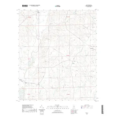
2020 Map of Ino
USGS Topo · Published 2020About this map
The Pea River winds southward through the heart of this Coffee County landscape, defining the topography south of Elba. Small rural communities including Ino and Damascus anchor the crossroads of a dense network of county roads, where historic burial grounds like Bethlehem Cem and Mount Gilled Cem reveal the patterns of local family heritage. The map documents an area deeply tied to its watercourses, with numerous named branches and creeks such as Tight Eye Cr, Kimmy Cr, and Beaverdam Br feeding into the main river channel.
Find a feature on this map
85 named features on this map. Tap any name to fly to it.
Don’t see what you’re looking for? This feature index may not catch every label — zoom into the map to look around manually.
Map Details
Editions of this 2020 Ino Map
This is the sole edition of this map. No revisions or reprints were ever made.
Other maps of this area

1942 · Enterprise
USGS Topo · 1:125,000

1950 · Enterprise
USGS Topo · 1:62,500

1953 · Andalusia
USGS Topo · 1:250,000

1953 · Dothan
USGS Topo · 1:250,000

1954 · Dothan
USGS Topo · 1:250,000

1955 · Dothan
USGS Topo · 1:250,000

1957 · Andalusia
USGS Topo · 1:250,000

1957 · Geneva
USGS Topo · 1:62,500
1957 · Coffee Springs
USGS Topo · 1:24,000
1960 · Goodman
USGS Topo · 1:24,000