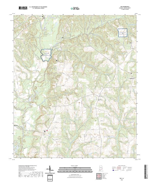
2024 Map of Ino
USGS Topo · Published 2024About this map
The Pea River and its numerous tributaries, including Helms Mill Creek and Wises Mill Creek, define the landscape of south-central Coffee County. This region is characterized by a network of small rural settlements such as Ino, Damascus, and Alberton, many of which are anchored by long-standing community landmarks like Ino Cem and Mount Gilled Cem. The map reveals the modern military footprint in the area with the presence of Runkle Stagefield Al and Stinson 5ab Stagefield Al, training fields that share the landscape with traditional agricultural and timber lands. Water resources are central to the geography here, from the southern reaches of Ellis-Wise Lake to the drainage of Phillips Mill Branch, illustrating the transition from upland woods to the creek bottoms of the Alabama Wiregrass.
Find a feature on this map
83 named features on this map. Tap any name to fly to it.
Don’t see what you’re looking for? This feature index may not catch every label — zoom into the map to look around manually.
Map Details
Editions of this 2024 Ino Map
This is the sole edition of this map. No revisions or reprints were ever made.
Other maps of this area

1942 · Enterprise
USGS Topo · 1:125,000

1950 · Enterprise
USGS Topo · 1:62,500

1953 · Andalusia
USGS Topo · 1:250,000

1953 · Dothan
USGS Topo · 1:250,000

1954 · Dothan
USGS Topo · 1:250,000

1955 · Dothan
USGS Topo · 1:250,000

1957 · Andalusia
USGS Topo · 1:250,000

1957 · Geneva
USGS Topo · 1:62,500
1957 · Coffee Springs
USGS Topo · 1:24,000
1960 · Goodman
USGS Topo · 1:24,000