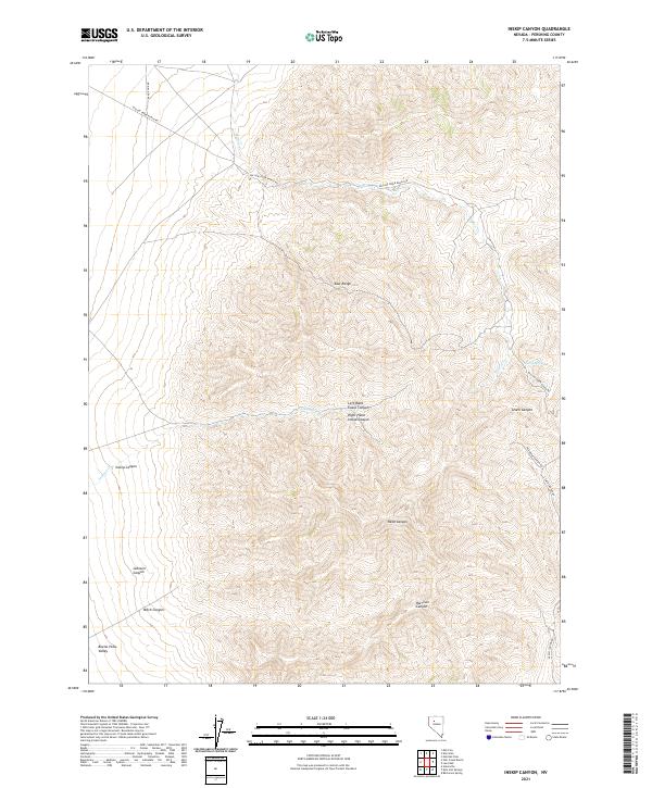
2021 Map of Inskip Canyon
USGS Topo · Published 2021About this map
The East Range dominates this portion of Pershing County, characterized by a series of steep drainages including the prominent Inskip Canyon. The terrain transitions from the high ridges of the mountains down into the flat expanse of the Buena Vista Valley to the southwest. This landscape is defined by its seasonal water sources and ranching access, with Inskips Cr and Willow Cr providing the primary drainage patterns through the canyons.
Find a feature on this map
23 named features on this map. Tap any name to fly to it.
Don’t see what you’re looking for? This feature index may not catch every label — zoom into the map to look around manually.
Map Details
Editions of this 2021 Inskip Canyon Map
This is the sole edition of this map. No revisions or reprints were ever made.
Other maps of this area

1931 · Lovelock
USGS Topo · 1:250,000

1932 · Sonoma Range
USGS Topo · 1:250,000

1935 · Lovelock
USGS Topo · 1:250,000

1939 · Sonoma Range
USGS Topo · 1:250,000

1954 · Unionville
USGS Topo · 1:62,500

1955 · Lovelock
USGS Topo · 1:250,000

1955 · Winnemucca
USGS Topo · 1:250,000

1956 · Imlay
USGS Topo · 1:62,500

1958 · Winnemucca
USGS Topo · 1:250,000

1959 · Lovelock
USGS Topo · 1:250,000