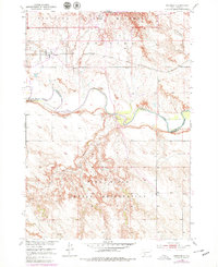
1950 Map of Interior
USGS Topo · Published 1979About this map
Interior stands at the northern edge of the Pine Ridge Indian Reservation, where the prairie landscape transitions into the distinctive formations of the Badlands National Monument. This 1950 survey, updated with 1970s photodata, records the essential infrastructure of Jackson and Washabaugh Counties before regional reorganization. The Chicago Milwaukee St Paul and Pacific rail line cuts across the northern terrain, serving the local economy near the Monument Hdqrs. To the south, the meandering White River serves as a critical geographic boundary, flanked by tributary drainage from Sixteenmile and Lost Dog Creek. The map documents a period when the Pine Ridge upland and the surrounding badlands were being managed for conservation and tribal use, preserving the 20th-century footprint of this South Dakota landscape.
Find a feature on this map
14 named features on this map. Tap any name to fly to it.
Don’t see what you’re looking for? This feature index may not catch every label — zoom into the map to look around manually.
Map Details
Editions of this 1950 Interior Map
2 editions found
Other maps of this area

1950 · Interior
USGS Topo · 1:24,000

1950 · Interior SE
USGS Topo · 1:24,000

1950 · Potato Creek
USGS Topo · 1:24,000

1951 · School Section Butte
USGS Topo · 1:24,000

1952 · Conata NE
USGS Topo · 1:24,000

1952 · Conata SE
USGS Topo · 1:24,000

1955 · Hot Springs
USGS Topo · 1:250,000

1955 · Martin
USGS Topo · 1:250,000

1958 · Martin
USGS Topo · 1:250,000

1960 · Wall SE
USGS Topo · 1:24,000