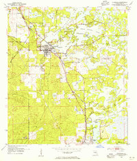
1954 Map of Inverness
USGS Topo · Published 1965About this map
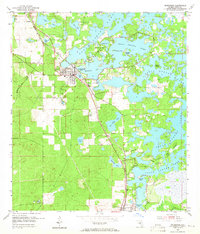
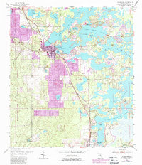
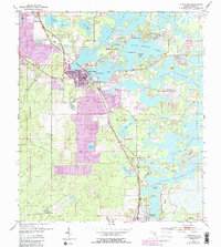
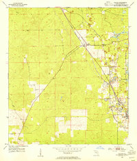
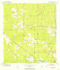
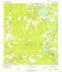
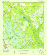
Tsala Apopka Lake dominates the eastern half of this mid-century landscape, a complex system of islands and peninsulas including Gospel Island and Cabbage Island. In the mid-1950s, the citrus-growing region of Citrus County centers on Inverness, where the Seaboard Air Line and Atlantic Coast Line railroads intersect. This transportation hub supported a local economy tied to both agriculture and extraction, evidenced by the Hamburg Mine and a local Sand Pit located southwest of the city center.
Find a feature on this map
30 named features on this map. Tap any name to fly to it.
Don’t see what you’re looking for? This feature index may not catch every label — zoom into the map to look around manually.
Map Details
Editions of this 1954 Inverness Map
4 editions found
Other maps of this area

1893 · Panasoffkee
USGS Topo · 1:62,500

1895 · Tsala Apopka
USGS Topo · 1:62,500

1895 · Panasoffkee
USGS Topo · 1:62,500
1954 · Lecanto
USGS Topo · 1:24,000
1954 · Holder
USGS Topo · 1:24,000
1954 · Brooksville NW
USGS Topo · 1:24,000
1954 · Nobleton
USGS Topo · 1:24,000
1954 · Tsala Apopka NE
USGS Topo · 1:24,000
1954 · Inverness
USGS Topo · 1:24,000
1954 · Inverness
USGS Topo · 1:62,500