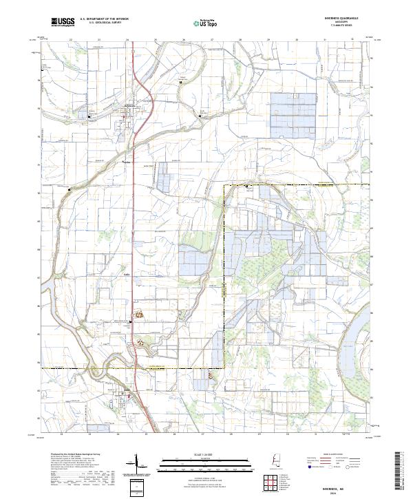
2024 Map of Inverness
USGS Topo · Published 2024About this map
Inverness serves as a central hub in this section of the Mississippi Delta, where the landscape is defined by the winding paths of Mound Bayou and Browns Bayou. The town's grid and the surrounding agricultural layout reveal a deep reliance on the alluvial plain, with numerous cemeteries like Saint Lawrence Cem and Mount Moriah Cem scattered among the fields, marking the generational history of local families. To the south, the settlement of Isola sits near the border of Sunflower and Humphreys counties, connected to the larger region by a network of farm-to-market roads like Tram Rd and Inverness Rd. The presence of the Farm Service Agency Interest of Mississippi tract and the expansive Sky Lake Swamp illustrate the ongoing management of this fertile but flood-prone terrain, where smaller communities like Caile and Bowles maintain their identity amidst large-scale cultivation.
Find a feature on this map
95 named features on this map. Tap any name to fly to it.
Don’t see what you’re looking for? This feature index may not catch every label — zoom into the map to look around manually.
Map Details
Editions of this 2024 Inverness Map
This is the sole edition of this map. No revisions or reprints were ever made.
Other maps of this area

1940 · Auter
USGS Topo · 1:62,500

1940 · Baird
USGS Topo · 1:62,500

1940 · Mileston
USGS Topo · 1:62,500

1953 · Greenwood
USGS Topo · 1:250,000

1954 · Mileston
USGS Topo · 1:62,500

1956 · Greenwood
USGS Topo · 1:250,000

1961 · Mossy Lake
USGS Topo · 1:62,500

1965 · Inverness
USGS Topo · 1:24,000

1965 · Indianola
USGS Topo · 1:24,000

1965 · Kinlock
USGS Topo · 1:24,000