
1957 Map of Inwood
USGS Topo · Published 1958About this map
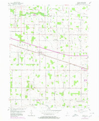
Inwood serves as the central hub of this mid-century Indiana landscape, situated where the Pennsylvania railroad and the Lincoln Pennsylvania Highway intersect. The settlement pattern follows a rigid grid of rural roads, including North Hawthorn Road and South Filbert Road, which bisect the agricultural fields of Center, Bourbon, and Walnut townships. To the north, the Yellow River meanders across the territory, providing a natural break in the otherwise systematic land divisions. Local landmarks such as the Bethel Ch and the Salem Cem offer specific points of interest for those tracing family roots in Marshall County. Industrial and utility infrastructure is also evident, including a Gravel Pit, Storage Bins, and a Sub Sta, reflecting the functional mid-century rural economy of the region.
Find a feature on this map
43 named features on this map. Tap any name to fly to it.
Don’t see what you’re looking for? This feature index may not catch every label — zoom into the map to look around manually.
Map Details
Editions of this 1957 Inwood Map
Other maps of this area

1953 · Chicago
USGS Topo · 1:250,000

1957 · Chicago
USGS Topo · 1:250,000

1957 · Plymouth
USGS Topo · 1:24,000

1958 · Bremen
USGS Topo · 1:24,000

1958 · La Paz
USGS Topo · 1:24,000

1958 · Nappanee West
USGS Topo · 1:24,000

1958 · Bourbon
USGS Topo · 1:24,000

1959 · Mentone
USGS Topo · 1:24,000

1962 · Argos
USGS Topo · 1:24,000
1962 · Rutland
USGS Topo · 1:24,000