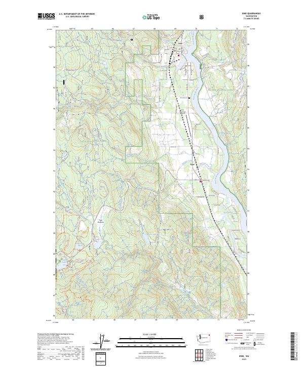
2023 Map of Ione
USGS Topo · Published 2023About this map
The Pend Oreille River flows northward through this section of the Colville National Forest, creating a narrow corridor of settlement and transport between the Selkirk Mountains. The town of Ione serves as the primary hub, where the Ione Municipal Airport and Riverside Cem are established near the riverbanks. To the south, the smaller settlement of Tiger sits at the junction of several forest roads, marking a historic point of transition into the more marshy terrain of Tiger Meadows.
Find a feature on this map
70 named features on this map. Tap any name to fly to it.
Don’t see what you’re looking for? This feature index may not catch every label — zoom into the map to look around manually.
Map Details
Editions of this 2023 Ione Map
This is the sole edition of this map. No revisions or reprints were ever made.
Other maps of this area

1929 · Colville
USGS Topo · 1:125,000

1933 · Colville
USGS Topo · 1:125,000

1934 · Metaline
USGS Topo · 1:125,000

1942 · Metaline
USGS Topo · 1:125,000

1952 · Deep Lake
USGS Topo · 1:24,000

1958 · Sandpoint
USGS Topo · 1:250,000

1963 · Sandpoint
USGS Topo · 1:250,000
1966 · Lake Gillette
USGS Topo · 1:24,000
1967 · Aladdin Mtn
USGS Topo · 1:24,000

1967 · Timber Mtn.
USGS Topo · 1:24,000