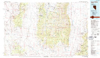
1985 Map of Ione Valley
USGS Topo · Published 1985About this map
Manhattan and Round Mountain anchor this mid-1980s look at the high desert and mountain ranges of Nye and Mineral counties. The map details a landscape defined by its mining heritage, from the large-scale Manhattan Dredge Tailings to historic sites like Berlin, now preserved within Berlin-Ichthyosaur State Park. Several former settlements are marked as sites, including Downeyville, Goldyke, and Atwood, providing a clear record of the area's shifting population centers.
Find a feature on this map
77 named features on this map. Tap any name to fly to it.
Don’t see what you’re looking for? This feature index may not catch every label — zoom into the map to look around manually.
Map Details
Editions of this 1985 Ione Valley Map
2 editions found
Other maps of this area

1907 · Tonopah
USGS Topo · 1:250,000

1908 · Tonopah
USGS Topo · 1:250,000

1908 · Carson Sink
USGS Topo · 1:250,000

1909 · Hawthorne
USGS Topo · 1:250,000

1910 · Carson Sink
USGS Topo · 1:250,000

1911 · Hawthorne
USGS Topo · 1:250,000

1915 · Hawthorne
USGS Topo · 1:250,000

1926 · Roberts Mountains
USGS Topo · 1:250,000

1929 · Roberts Mountains
USGS Topo · 1:250,000

1948 · Paradise Peak
USGS Topo · 1:62,500