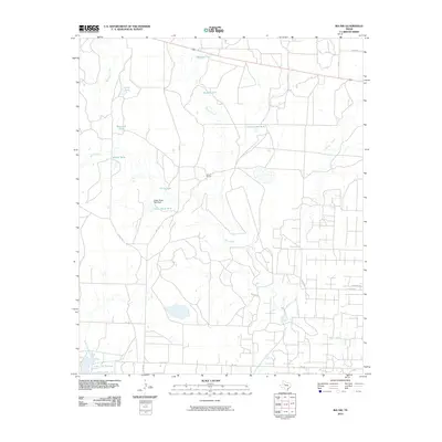
2010 Map of Ira NW
USGS Topo · Published 2010About this map
Lake J B Thomas dominates the southwest corner of this West Texas landscape, serving as a primary water source for this arid region of Scurry County. The surrounding terrain is defined by a network of drainage systems including Gavett Creek, Bull Creek, and Red Mud Creek, which are augmented by numerous stock tanks such as Wascomb Tank, Clear Tank, and Polly Tank. This infrastructure underscores the area's historical and continuing reliance on ranching, as evidenced by the presence of the Nine R Ranch.
Find a feature on this map
24 named features on this map. Tap any name to fly to it.
Don’t see what you’re looking for? This feature index may not catch every label — zoom into the map to look around manually.
Map Details
Editions of this 2010 Ira NW Map
This is the sole edition of this map. No revisions or reprints were ever made.
Other maps of this area

1951 · Ira SW
USGS Topo · 1:24,000

1951 · Ira
USGS Topo · 1:24,000

1951 · Ira NW
USGS Topo · 1:24,000

1952 · Ira NE
USGS Topo · 1:24,000

1954 · Dermott
USGS Topo · 1:24,000

1954 · Big Spring
USGS Topo · 1:250,000

1958 · Big Spring
USGS Topo · 1:250,000

1969 · Arah
USGS Topo · 1:24,000
1969 · Fivemile Creek
USGS Topo · 1:24,000
1970 · Gunsight Draw NE
USGS Topo · 1:24,000