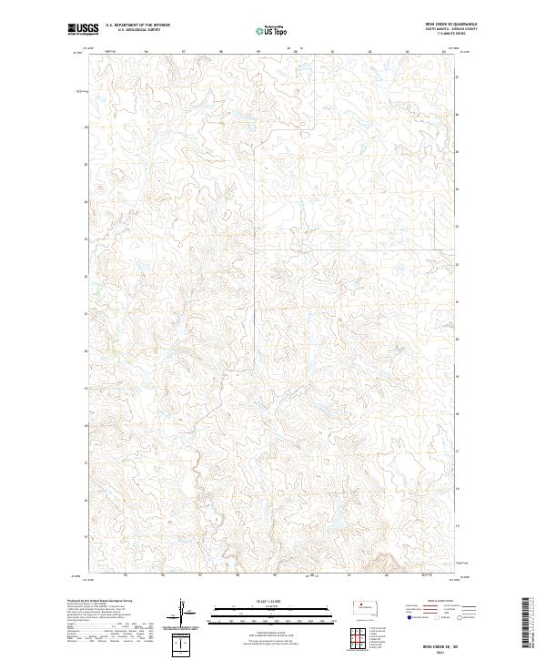
2021 Map of Irish Creek SE
USGS Topo · Published 2021About this map
Irish Cr and its tributaries carve a complex drainage pattern across this Ziebach County landscape. This 2021 digital survey illustrates the intricate topography of the northern Great Plains, defined by the winding paths of E Irish Cr and Red Earth Cr. The land is organized by the Public Land Survey System, with the boundaries of t16n r20e, t16n r21e, t15n r20e, and t15n r21e providing a grid-like framework over the natural contours. This map is particularly valuable for understanding modern land division and water management in a region where seasonal creeks dictate the character of the terrain.
Find a feature on this map
7 named features on this map. Tap any name to fly to it.
Don’t see what you’re looking for? This feature index may not catch every label — zoom into the map to look around manually.
Map Details
Editions of this 2021 Irish Creek SE Map
This is the sole edition of this map. No revisions or reprints were ever made.
Other maps of this area

1951 · Dupree NE
USGS Topo · 1:24,000

1951 · Thunder Butte
USGS Topo · 1:24,000

1952 · Lantry NW
USGS Topo · 1:24,000

1953 · McIntosh
USGS Topo · 1:250,000

1958 · McIntosh
USGS Topo · 1:250,000

1978 · Isabel SW
USGS Topo · 1:24,000

1978 · Isabel
USGS Topo · 1:24,000

1982 · Irish Creek SW
USGS Topo · 1:24,000
1982 · Irish Creek NW
USGS Topo · 1:24,000
1982 · Irish Creek SE
USGS Topo · 1:24,000