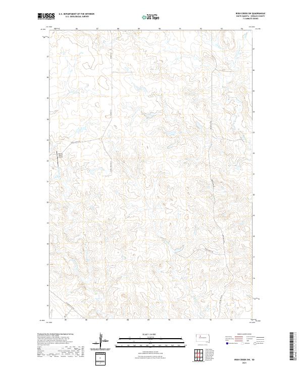
2021 Map of Irish Creek SW
USGS Topo · Published 2021About this map
Dorsey Ranch Airport and a network of namesake ranch roads define this section of Ziebach County, where the landscape is carved by the intermittent drainage of the Cheyenne River watershed. The map details a remote agricultural territory where movement is dictated by private tracks like Dorsey Ranch Rd 1 and Young Ranch Rd. The hydrology of the region is centered on several winding prairie streams, including Sophia Cr, Beaver Trap Cr, and its western fork, W Beaver Trap Cr. This 2021 survey illustrates the modern configuration of large land holdings and the essential infrastructure required to navigate the expansive plains of north-central South Dakota, including Thunder Butte Rd and the northern reaches of Irish Cr.
Find a feature on this map
17 named features on this map. Tap any name to fly to it.
Don’t see what you’re looking for? This feature index may not catch every label — zoom into the map to look around manually.
Map Details
Editions of this 2021 Irish Creek SW Map
This is the sole edition of this map. No revisions or reprints were ever made.
Other maps of this area

1951 · Redelm NE
USGS Topo · 1:24,000

1951 · Dupree NE
USGS Topo · 1:24,000

1951 · Thunder Butte
USGS Topo · 1:24,000

1953 · McIntosh
USGS Topo · 1:250,000

1958 · McIntosh
USGS Topo · 1:250,000

1982 · Glad Valley
USGS Topo · 1:24,000

1982 · Irish Creek SW
USGS Topo · 1:24,000
1982 · Irish Creek NW
USGS Topo · 1:24,000

1982 · Glad Valley SE
USGS Topo · 1:24,000
1982 · Irish Creek SE
USGS Topo · 1:24,000