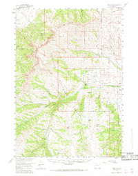
1957 Map of Irish Rock
USGS Topo · Published 1968About this map
Shoshone National Forest defines the character of this high-altitude landscape in the late 1950s, dominated by the massive Carter Mountain and the deep drainage of the Greybull River. This area is characterized by isolated outposts and high-country routes, where life centered on the scattered ranching operations along the riverbanks. The map documents several key pastoral locations, including Palette Ranch No 1, Palette Ranch No 2, and Homestead Ranch, which served as anchors for habitation in this remote region. High-elevation points like Irish Rock and Aldrich Basin are connected by a network of historic pathways, such as the Warhouse Trail and Haymaker Trail. The presence of the Jack Creek Cabin and Venus Creek Cabin suggests a history of seasonal work or forest management deep within the basins of Jack Creek and Venus Creek, providing a detailed look at the infrastructure required to manage these extensive forest lands.
Find a feature on this map
48 named features on this map. Tap any name to fly to it.
Don’t see what you’re looking for? This feature index may not catch every label — zoom into the map to look around manually.
Map Details
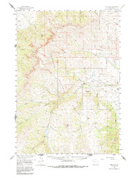
Editions of this 1957 Irish Rock Map
3 editions found

Other maps of this area

1893 · Ishawooa
USGS Topo · 1:125,000

1895 · Ishawooa
USGS Topo · 1:125,000

1899 · Ishawooa
USGS Topo · 1:125,000

1904 · Kirwin
USGS Topo · 1:125,000

1905 · Younts Peak
USGS Topo · 1:125,000

1906 · Kirwin
USGS Topo · 1:125,000

1907 · Younts Peak
USGS Topo · 1:125,000

1955 · Cody
USGS Topo · 1:250,000

1955 · Thermopolis
USGS Topo · 1:250,000

1956 · Emerald Lake
USGS Topo · 1:24,000