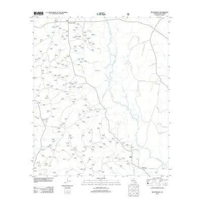
2012 Map of Iron Branch
USGS Topo · Published 2012About this map
Brewtons Mill and the southern reaches of the Dugdemona River basin define this portion of Winn Parish. The landscape is a network of smaller tributaries including Cypress Cr, Big Br, and Iron Br, which carve through the piney woods and bottomlands of north-central Louisiana. Industrial and utility footprints are visible through the Calvin Gas Field and the Sparte Lookout Tower, while local history is marked by the unique Prices Salt Lick near Mile Br. A complex grid of timber and parish roads, such as Yankee Springs Rd and Gum Springs Rd, connects scattered rural homesites and the community of Bethlehem. This map illustrates the intersection of traditional river-bottom topography with modern forestry and energy extraction, providing a clear record of the area's rural development.
Find a feature on this map
40 named features on this map. Tap any name to fly to it.
Don’t see what you’re looking for? This feature index may not catch every label — zoom into the map to look around manually.
Map Details
Editions of this 2012 Iron Branch Map
This is the sole edition of this map. No revisions or reprints were ever made.
Other maps of this area

1947 · Goldonna
USGS Topo · 1:62,500

1949 · Calvin NE
USGS Topo · 1:31,680

1949 · Calvin NW
USGS Topo · 1:31,680

1949 · Jonesboro
USGS Topo · 1:62,500

1950 · Jonesboro
USGS Topo · 1:62,500

1950 · Winnfield
USGS Topo · 1:62,500

1951 · Winnfield
USGS Topo · 1:62,500

1953 · Alexandria
USGS Topo · 1:250,000

1955 · Shreveport
USGS Topo · 1:250,000

1955 · Alexandria
USGS Topo · 1:250,000