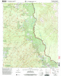
2003 Map of Iron Branch
USGS Topo · Published 2005About this map
Kisatchie National Forest land dominates this 2003 survey of Winn Parish, where the winding path of the Dugdemona River forms a natural eastern boundary. The landscape is a mosaic of public timberland and small agricultural clearings, punctuated by the headwaters of Cypress Creek, Iron Branch, and Mile Branch. Evidence of local industry is visible through several marked Drill Holes, Oil Wells, and a Gravel Pit, reflecting the area's history of natural resource extraction.
Find a feature on this map
18 named features on this map. Tap any name to fly to it.
Don’t see what you’re looking for? This feature index may not catch every label — zoom into the map to look around manually.
Map Details
Editions of this 2003 Iron Branch Map
This is the sole edition of this map. No revisions or reprints were ever made.
Other maps of this area

1947 · Goldonna
USGS Topo · 1:62,500

1949 · Calvin NE
USGS Topo · 1:31,680

1949 · Calvin NW
USGS Topo · 1:31,680

1949 · Jonesboro
USGS Topo · 1:62,500

1950 · Jonesboro
USGS Topo · 1:62,500

1950 · Winnfield
USGS Topo · 1:62,500

1951 · Winnfield
USGS Topo · 1:62,500

1953 · Alexandria
USGS Topo · 1:250,000

1955 · Shreveport
USGS Topo · 1:250,000

1955 · Alexandria
USGS Topo · 1:250,000