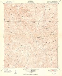
1949 Map of Iron Mountain
USGS Topo · Published 1949About this map
Cliff Dwellings and high-desert landmarks define this 1949 survey of the Pinal and Maricopa county line. The landscape is a complex of canyons and peaks within the Tonto National Forest and Crook National Forest, where water sources like Reevis Creek and Tortilla Creek dictated human activity. The map records the intersection of ranching history and early exploration, noting the Reevis Ranch and the solitary Reevis Grave nearby.
Find a feature on this map
53 named features on this map. Tap any name to fly to it.
Don’t see what you’re looking for? This feature index may not catch every label — zoom into the map to look around manually.
Map Details
Editions of this 1949 Iron Mountain Map
2 editions found

Other maps of this area

1900 · Florence
USGS Topo · 1:125,000

1902 · Florence
USGS Topo · 1:125,000

1907 · Roosevelt
USGS Topo · 1:125,000

1909 · Four Peaks
USGS Topo · 1:125,000

1912 · Roosevelt
USGS Topo · 1:125,000

1948 · Superior
USGS Topo · 1:62,500

1948 · Superior
USGS Topo · 1:24,000

1948 · Iron Mountain
USGS Topo · 1:24,000
1948 · Haunted Canyon
USGS Topo · 1:24,000

1948 · Picketpost Mtn
USGS Topo · 1:24,000