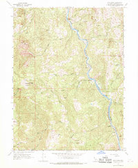
1967 Map of Iron Peak
USGS Topo · Published 1969About this map
The Eel River carves a deep canyon through this portion of Mendocino County, serving as the primary corridor for the Northwestern Pacific railroad. This 1967 field-checked survey reveals a landscape where human presence is defined by isolated family holdings and small river-side outposts. Several named sites like Cliff Spyrock Place, Dunlap Place, and the Ralph Leggett Place indicate a history of local land ownership and homesteading along the steep slopes.
Find a feature on this map
37 named features on this map. Tap any name to fly to it.
Don’t see what you’re looking for? This feature index may not catch every label — zoom into the map to look around manually.
Map Details
Editions of this 1967 Iron Peak Map
3 editions found
Other maps of this area

1920 · Cummings
USGS Topo · 1:62,500

1920 · Covelo
USGS Topo · 1:62,500

1921 · Branscomb
USGS Topo · 1:62,500

1951 · Branscomb
USGS Topo · 1:62,500

1951 · Laytonville
USGS Topo · 1:62,500

1952 · Spyrock
USGS Topo · 1:62,500

1952 · Leggett
USGS Topo · 1:62,500

1957 · Ukiah
USGS Topo · 1:250,000

1960 · Ukiah
USGS Topo · 1:250,000
1967 · Covelo West
USGS Topo · 1:24,000